Places I Have Been

Tuesday, January 21, 2014

Aloha 'oe, Hawai'i

Having been in Hawaii for a week, it was now time to go visit Hawaii. Or as it is known locally, the Big Island. The newest island in the chain at about 400,000 years of age,  (another, Loihi, is forming south of Big Island and will be available for tourists to visit 10 to 100 thousand years from now when it emerges from the Pacific), the Big Island is the largest of the Hawaiian Islands at over 10,000 square kilometres. It is formed from five shield volcanos, the largest of which, Mauna Loa, comprises over half of the area of the Big Island. The highest mountain on earth (if measured from its base to summit at 10,100 metres), is also on the Big Island. Of course Mauna Kea is mostly underwater, so just 4,207 metres is above sea level. Still, this is high enough for the mountain to be snow covered in the winter. Mauna Kea, and Kilauea are the two active volcanos in Hawaii, with Kilauea being the more active and it was erupting - sort of - while we were there. We will visit Kilauea later in this chapter.
Hilo Rain Forest

We flew into Hilo arriving about 10:15 a.m., the largest of the metropilitan areas on the Big Island. Hilo is on the windward side of the Big Island, so it is classified as tropical rain forest. Indeed, with around 275 days of rain and an average rainfall of 3 metres, the vegetation and predominant colour around the area is in a word, green. Hilo houses all have metal roofs presumably to keep moss and other plants from growing on them. We lucked out weather wise, because when we arrived, it was a mostly sunny day. But it was very hot and humid.

We had reserved another Jeep Cherokee SUV for our travels on the Big Island, but when we went to pick it up, all they had left was a very small Jeep and an SUV that would make the FBI envious. All black, and about the length of a rail car, the 9 seat Chevy Suburban sure seemed comfortable when we literally climbed aboard, and with all possible options known to humankind (I am sure it was also amour clad), we decided to take it - what choice did we really have? We asked the rental agent what the gas mileage was like, he said he drove it from time to time and he got about 25 mpg (US gallon) or 9 litres per 100 km. Uh, huh. Never believe a car rental agent as we were to find out.
Rainbow Falls

As we pulled out of the parking lot, I cupped my hands and yelled across to my brother-in-law who was seated what seemed to me to be about 5 metres away that our first business of the day was to get some provisions for our drive before we left Hilo and the built up area. So we checked the GPS and found a grocery store less than a kilometre away. After filling up on snacks and water, we headed for our first destination, just on the northern fringes of Hilo. Rainbow Falls (Waianuenue in Hawaiian) is about 25 metres tall and is right next to the parking lot of Wailuku River State Park. We fell out of our SUV to check it out. We did not see a rainbow, but it was worth a stop. The Hawaiian Goddess, Hina, is said to live in the lava cave behind the falls. We did not see her either. Maybe she needs a rainbow to appear?

Roadside Colours
Since Hina was busy elsewhere, we started our drive out of Hilo along the Mamalahoa Highway (of course in Hawaii it cannot have just one name; it is also called the Hawaii Belt Road and Highway 19) that heads just inland along the coast north towards Waimea. We were going to be based near Kailua-Kona on the other side of the island for the next couple of nights, so we had about 150 kilometres to drive, barring stops along the way to admire the scenery. If we did not stop, this would be about a 2 hour drive as the road that circumnavigates the Big Island is pretty good with a decent speed limit. 

Actually, the highway was too good where we were to see much of anything other than houses, so just outside of town, we veered right onto the Old Mamalahoa Highway which hugs the coast at Onomea Bay (it is hard to know you are close to the coast because the tropical rainforest vegetation is really dense, overhanging the road and blocking the view beyond a couple of metres for the most part). The narrow and twisting road reminded us of the Road to Hana. I am not sure I would classify the road we were on as a highway despite its name. There were lots of flowers in the trees and alongside the road, and some rocks, coconuts and other vegation on the road for added atmosphere with the odd house hidden among the trees. 

What's Shakin'
As it was now early afternoon, our stomachs informed us that it was time to eat. A quick search of the GPS indicated that the only restaurant nearby was a drive-in called What's Shakin'. With visions of hamburgers and milkshakes in our heads, we continued up the Old Mamalahoa Highway for a couple more kilometres to the restaurant. We had the drive-in part right, at least we had to drive into the parking lot. There are picnic tables beside the food prep area located in a small building so it is not a drive-through. (I wonder if there are any drive throughs in Hawaii?). And there were no hamburgers or milkshakes. Instead, we ordered freshly made turkey and fish wraps with avocado picked from the farm behind What's Shakin'. Mango smoothies were also on the menu and were quite delicious. This is definitely worth a stop for lunch if you are in the area. It certainly attracts Canadians; the four people at the table beside us were from Hamilton. Located slightly up a hill, the view out toward the ocean from the picnic tables added to the great food.

Akaka Falls
Completely refreshed, we headed towards our next stop. Billed as 135 metres high, Akaka Falls located in a State Park of the same name, put Rainbow Falls in the small trickle category. The 6 km drive up to the State Park from the Mamalahoa Highway travels through the village of Honomu, fields and orchards. There is a $5 parking fee if you enter the park (many cars were parked on the road before the park to evade the fee). We chose to go in and pay our fee (strangely enough, a park employee was sitting on a chair at the automated self-pay machine, which is a good thing because the machine is almost impossible to figure out). There are two trails to get to the actual falls, the longer 1 km trail goes by Kahuna cascades before arriving at Akaka, the shorter and easier which we took, is about 200 metres long. Both trails go through a dense rain forest and although the shorter was paved, it is slippery from the constant moisture dripping on it from the thick foliage overhead.

While checking out the signage describing Akaka Falls, I noticed that it claimed to be 2 1/2 times higher than Niagara Falls. It very well may be, but how can you take the official State information seriously when the comparison photo of Niagara Falls was labelled Niagara Falls, New York; yet it was a photo of the Horseshoe Falls (which are completely within Canada) taken from an Ontario viewpoint? I wrote to the Governor of Hawaii later to suggest he and his employees correct this mistake in geography and asked for an explanation. I have not received a response to date. Since we know the Governor and his staff don't know where Canada is, they probably will never contact me. So in retaliation, I hereby declare the City of Ontario, in California, from this date forward, to be Canadian.

Laupahoehoe Point

We continued up the Mamalahoa Highway which became very scenic as we headed north. We crossed several deep and narrow river gorges that cut deeply into the volcanic rock. Where the gorges were wide, the road went inland to a narrower part, crossed a high bridge and then swung back out towards the coast on the other side. We stopped on the highway to look at Laupahoehoe Point far below us before heading off the highway to the Laupahoehoe Point Road, a narrow, winding and quickly descending road that dropped down to the coast. At the bottom, a large park with grass, restroom facilities and a campsite greeted us. Several people were picnicing and enjoying the park facilities. And at the end of the road, a protected boat launch has been built into the lava that projects out into the water. The surf was magnificent as it pounded the rocky shoreline, spraying high up into the air. But not as high as the 20 metre tsunami that killed 21 schoolchildren here on April Fool's Day, 1946.

As we continued up the coast, the clouds started to roll in. Clouds in the afternoon is a common occurence in Hawaii. We could see rain cells forming out on the ocean, however, thankfully the rain held off over the land. Speaking of land, the vegetation was now changing from rain forest to open forest with pine trees and fields started to appear. We were heading into cattle country and the leeward side of the Island. 

Waipo Valley
We decided to make one more stop for the scenery and turned off the Mamamlahoa Highway just before it turned west at the town of Honokaa onto the Waipo Valley Road. A 12 kilometre drive brought us to the official end of the Road at the Waipo (it means curved water in Hawaiian) Valley where we enjoyed the spectacular view of the valley and coastline far below us. Once home to thousands of Hawaiians, only about 50 people still live in the valley, farming taro and other crops. Our rental agreement prohibited us from going down into the valley as the single lane road has grades that exceed 25% as it drops 244 metres in less than a kilometre.  As well, signs at the lookout suggested that because the Valley is now a protected reserve with ancient historical gravesites of former Hawaiian kings, heiaus (temples) and homesites, visitors are discouraged from going into the valley unless on official tours sanctioned by the people who live there.
Lava Flow Near Kona

Back at the main road, we turned west once more. We were now crossing the foothills of the Kohala Mountains and the rolling terrain and fields of beef cattle signified we were now deep into cowboy country as we approached the town of Waimea. Indeed, the Parker Ranch, one of the largest privately owned ranches in the US at 250,000 acres, is located here. By the time we got to Waimea, it was late afternoon. We decided to pick up some liquid provisions here for our Bed and Breakfast. 

Descending from the rolling hills just outside Waimea, we went through a desert (complete with prickly pear cacti) and then through several kilometres of lava flows which covered the ground as far as the eye could see, from the cinder cones on the flanks of Mauna Kea to the left of us all the way down to the sea in the distance on the right. Only scrub brush grew here. 
Mango Sunset

After crossing the lava plains, we started up into the hills again, and soon came to the turn for our Bed and Breakfast. Called the Mango Sunset, it is situated on a working coffee (Kona) farm. We were greeted by a couple of the workers, students from the States on farm labour programs. Our hostess soon came by and showed us to our rooms and helped us settle in. The view, from 650 metres up on Hualalai Volcano out over the coffee plants and flowers to the sea far below was stupendous. And later that afternoon as we were enjoying a drink out on the lanai with fellow travellers from Sweden while the sun was settingwe found out why the place has the name it has. Dinner that evening was down the hill in Kailua-Kona at a small Thai restaurant. It had been a long day, but a good one.

Hungry Anyone?
The next morning, breakfast was served out in the gazebo. What a great place to start the day. Fresh fruit, several different kinds of crepes and kona coffee, all made by our host was accompanied by lots of discussion. Since our host was originally from Germany, the other two guests were Swedes and we were from Canada, the discussion tended to revolve around social issues and the virtues of state medicine, pensions and other benefits that the majority of civilized countries offer their citizens. We also talked about Remembrance Day (Called Veterans Day in the US) since it was November 11 and how our respective countries commemorated our war dead. Our hosts' young daughter was dressed in her Guide uniform as she was participating later that morning in a service at the nearby West Hawaii Veterans' Cemetery.

The evening before, while trying to park our SUV land yacht in the small drive at the back of the Bed and Breakfast, we decided to see if we could "trade" it for something a bit more reasonable. Perhaps something less than 4 metres long. So we called the rental agent at the Kona airport and he told us to bring it on down for a swap. Which we did after putting about a million gallons of gas into it at the nearby Costco (and we had only driven 150 km!). I think we should have received two rentals for the trade of the Suburban based on the size of the respective vehicles, but we did end up with a reasonable trade. Then we headed up the coast on Highway 19 (or the Queen Kaahumanu Highway) to find a beach and to see what other adventures we could have on this glorious sunny Remembrance Day. 

Lava lamp mine
Shortly after leaving Kona-Kahlui behind, we passed through another lava field. Alongside the road, people had painted some of the lava rocks white and had arranged them to spell out names, love messages and the odd advertisement. They really stood out against the black lava. This lava field lasted for quite a ways; it went as far as we could see into the distance. From time to time on the ocean side, we passed by exclusive resorts (with golf courses and even a private airport) and several  beach parks. The parks looked inviting with tall coconut palms swaying in the breeze, but we were aiming for Hapuna Beach State Recreation Area which our guide book listed as one of the top beaches on the Big Island and indeed in all of the United States. 

As we turned onto the beach road, we were stopped at the entrance gate. A large sign indicated that parking was free for Veterans Day. A much smaller sign said for Hawaiian citizens only. We had to pay $5. My brother-in-law asked how they knew we were not Hawaiians and the parking attendant pointed at the sticker on our windshield to indicate we were driving a rental car. I guess Hawaiians don't rent cars. And I guess the US does not recognize citizens from other countries that commemorate November 11.

Hapuna Beach
The parking lot was pretty full as Veterans Day is a Federal Holiday in the US. We parked, got our picnic stuff out of the back of the car and headed towards the beach. Hapuna Beach lived up to its reputation. It is a beautiful crescent shaped beach with white sand, a gentle yet fun surf to swim in the day we were there, lifeguards on duty and great picnic facilities. We walked up and down the length of the beach (after liberally applying sunblock), from the rocks of a lava protrusion on the south end, to a large hotel complex on the north end. Then we went for a very refreshing dip in the surf. Fresh water showers at the edge of the beach are provided to remove the sea salt after a swim. We sat at a picnic table afterwards, enjoying the freshening sea breeze and had some snacks as it was getting close to lunch time. 

Pu'ukohola Heiau
Leaving Hapuna Beach behind, we continued up past Mauna Kea Beach and its complex of resorts and golf courses to Pu'ukohola Heiau National Historic Site. As mentioned before in this blog, a heiau is a temple, a place that only the ali'i nui (high chiefs), kahunas (priests) and other high class Hawaiians could visit. Most heiaus are still Kapu (forbidden) to non native Hawaiians. The Pu'ukohola heiau was built by Kamehameha I in 1790, entirely by hand, with the red stones used in its construction being passed along a line of people that stretched 17 kilometres from a valley to the east.  Kamehameha ordered this heiau to be built to fulfil a prophecy made by a kahuna that the civil war among Hawaiian chiefs would end if the heiau was dedicated to the war god Ku. At the time, Kamehameha was fighting with his cousin who controlled the east side of Hawaii. Kamehameha invited his cousin to the temple dedication ceremony, supposedly to agree to a peace treaty between the two men. However, his cousin, who probably knew what was going to happen and should have declined the invitation, was captured and killed as part of the dedication ceremony. Thus began Kamehameha's drive to consolidate the islands. 

Comrade Castro
There is an excellent interpretive centre that explained Hawaiian society at the time the heiau was built, so we spent a good amount of time there. Then it was once more time to mount up and turning left at Kawaihae to Highway 270 (AKA Akone-Pule Highway, AKA Mahukona-Niulii Road), we continued along the coast to the tip of the Big Island and the town of Hawi. Nearby is the Kohala Historical Sites Monument which, in addition to another heiau, also portrays the birthplace of Kamehameha I (our GPS thought it was in another location on a dirt road - you can't always trust a GPS). We visited the small town instead of driving down to the Historic Sites, walking up and down its main street, checking out the shops and artist studios and enjoying the laid back lifestyle of Hawaii for an hour or so. At some point a branch of the Cuban revolution must have broken out here as evidenced by the statue to its leader that graces the front of a cigar emporium and general store.

Looking West from Hawi Road
We were now ready to head back to our Bed and Breakfast for afternoon refreshments, so we took Highway 250 (AKA Hawi Rd, AKA Kohala Mountain Rd) up over the Kohala mountains (large hills that are all that are left of the Kohala Volcano). This road between Hawi and Waimea is a beautiful drive and is well worth doing if you are in the area. Very few tourists actually take it, but I am glad we did. The highway climbs to 1200 metres through ranchland, ironwood and pine forests and the views of the Parker Ranch lands, the coastline we had visited earlier in the day, and the Queen Kaahumanu Highway far below was magnificent. I suspect it would have been even better in the morning as now we were staring into the late afternoon sun and glare from the ocean far below, as well as the usual gathering afternoon clouds. On a clear day, from our vantage point, you can see Mauna Kea Volcano inland to the left, and even Haleakala on Maui, over 80 kilometres away across the ocean.
More Lava near Kona

After descending into Waimea, we turned back onto Highway 19 (aka Hawaii Belt Rd, aka Mamalahoa Highway) and headed west. After having a bit of dejá vue as we drove along the main street of Waimea for the second time in as many days, we scurried across the lava plains once more to our Bed and Breakfast where we enjoyed some refreshments and watched the sun go down once again. That evening, we headed down the hill into town to have dinner at the Kona Brewing Company, a very popular (and thus overpriced) establishment. When we arrived at 7:00 p.m. there was still a large line (30 minute wait) to get in for dinner. The beer is good, (the wine was warm), the food mediocre to OK, the company great. We picked up some t-shirts and other Kona Brewing souvenirs for the folks back home before heading up the hill for our last night in Kailua-Kona.
Hulihe'e Palace Sea Front

The next morning, after another breakfast on the terrace, it was time to say goodbye to our hosts, say see you later to the Swedish girls who were going to the same bed and breakfast in Volcano later that day as us, and hit the road (the Hawaii Beltway, AKA .... you get the picture). We dropped down into Kona-Kaiua to visit the Hulihe'e Palace, a favourite summer home of some of Hawaii's former royalty.  Hawaiian Royalty had lived in and around this area since the 17th century and Kamehameha I made it the capital of the Islands after he became King of all Hawaii and before he moved the capital to Lahaina in Maui. The town remained a small fishing village, however, until tourism took off in Hawaii. 

First Hawaiian Church
We did not go into the Palace as it was just opening for the day, but walked around the palace grounds to check them out. Included on the grounds was the royal families personal fish pond, an ingenious square stone structure that allowed fresh water to enter with the tides, but kept the fish from leaving with the tides. Immediately across the road from the palace stands Mokuaikaua Church, the first Christian church in the Hawaiian Islands. The congregation dates back to 1820 (the original congregation is long gone) and the church has been in operation ever since. The current building, constructed from lava and coral, replaced previous wooden structures that burned down. A scale model of the Thaddeus, the brig that brought the first missionaries to Hawaii, is on display inside. Ships are still carrying out this tradition. Out in the harbour in front of the Palace, the cruise ship Celebrity Century was anchored, bringing other missionaries to Hawaii, this time to worship the climate.

After visiting a couple of stores on the walk back to the SUV, we once again headed back up the hill to the Hawaiian Beltway. The road travels high up from the water along the slope of Mauna Loa Volcano. Along the road, there are lots of houses, small commercial establishments, the odd resort and tons of Kona coffee farms. Our next stop was to be the bay where Captain James Cook ended his voyages of discovery. Or where I should say the Hawaiians ended them for him.

Captain Cook had quite a career. For those of us who live in Canada, he has quite a connection. He was involved in the capture of Louisbourg from the French, the Battle for Quebec on the Plains of Abraham in 1759 and spent five years surveying Newfoundland long before he was sent to the Pacific. He also surveyed the west coast of British Columbia on his last voyage to the Pacific.

Can you see Cook? How
about the snorkelers?
So after that brief Canadian history lesson, let's get back to Hawaii and the end of Cook. He visited Hawaii three times during his last voyage to the Pacific, the first time in January 1778 when he landed in Kuai and named the islands the Sandwich Islands (not because of the food he found, but after his boss, the Earl of Sandwich, First Lord of the Admiralty). In 1779, Cook returned to Hawaii from his trip to the west coast of North America, this time landing at Kealakekua Bay on the Big Island. Thought to be an incarnation of the god Lono (the festival for this god of fertility was underway when he landed), he remained for a month, exploiting this god status, until one his crewmen died. Now that the Hawaiians knew Cook and his men to be mere mortals, relations became somewhat strained. Cook soon left again to head back to North America (in search of the Northwest Passage). However, a mast on his ship broke soon after he left and he headed back to Kealakekua Bay. Three times unlucky, and with the Lono festival now over, Cook's party had worn out their welcome and was no longer venerated by the Hawaiians. When a dispute broke out about a stolen small boat, Cook tried to negotiate with the King for the return of the boat. Bad move. Shots were fired, a lesser Hawaiin King killed, and negotiations failed. When Cook was on the beach directing his boats to return to his ship, a mob struck him down and stabbed him and other crewmen to death. The crew of Cook's two ships retaliated by firing cannon at the Hawaiians, killing several. Because he had been considered a demi-god by the Hawaiians, they sacrificed his body at the heiau, then had the decency to keep his bones after boiling away the flesh. Now cooked in more ways than one, Cook's crew later received some of these bones from a friendly kahuna and buried what was left of him at sea.
Read the Label

We headed down Napoopoo Road from the village of Captain Cook to Kealakekua Bay to see where all this transpired. Unfortunately, the road does not go to the actual spot where he was killed, but stops across the bay at the heiau. The memorial to Cook, located in Kealakekua State Historical Park, can be reached by boat (or by going down a rough track on the other side of the bay). Local Hawaiians offer rides over to the memorial for a fee in zodiak boats, but we decided to check the memorial out with binoculars.The Hikiau heiau located at the end of Napoopoo Road where you look across to the memorial is the one that Cook visited prior to his death and most likely where his body was sacrified after his death. When talking to the Hawaiians here, we did find out that this bay is one of the best places to snorkel and to see dolphins.

Audrey Lives!
Heading back up Napoopoo Road, we stopped at the Kona Pacific Farms Cooperative. The oldest and largest Kona coffee cooperative in the States, our visit to the coffee mill was really interesting. The store clerk let us taste lots of different Kona coffees as well as fresh fruit from the area and macadamia nuts roasted at the mill. Chocolate covered coffee beans added to the tasting experience. They also have a small display about how Kona coffee is made as well as an extensive fruit tree aboretum that identifies the trees growing along winding paths so we did not have to guess at what they were. No charge to visit any of it. Of course, their tasting scheme works as a good marketing ploy; we did buy some nuts, coffee, chocolate covered coffee beans and other items.

Back up on the Beltway, we turned once more towards our eventual destination, the town of Volcano. But there was still plenty to see on our way there. We were now driving closer to Mauna Loa and we alternatively passed through thick vegation and lava flows that completely scarred the land. As we rounded the bottom of the island, we stopped at the small village of Ocean View. First, we visited the grocery store to acquire beverages and snacks for the evening to come, then we crossed the parking lot to a small restaurant for sandwiches as it was lunch time. 

Blowing in the Wind 

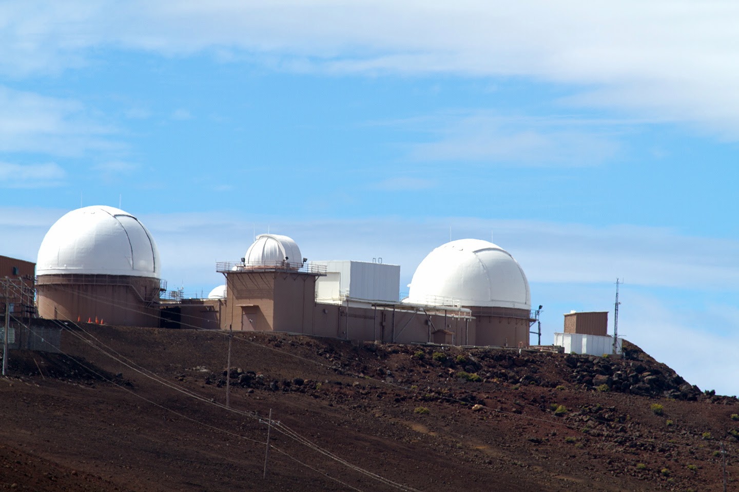
Back in the SUV, our next planned stop was to go see the Green Beach near South Point. South Point (Ka Lae in Hawaiian) is the most southerly point of the 50 United States. To get to it, you drive 20 kilometres out onto a peninsula, past ranches, military establishments (space radio telescopes, some surprisingly from the Swedish Space Administration's Universal Space Network) and a wind farm with its tall wind turbines visible on a ridge close to the ocean. The wind blows here almost constantly as evidenced by the shape of the rare trees that dot the landscape of the peninsula.
Kapu

Believed to be the original landing spot of the first Polynesians to reach Hawaii, most likely from Tahiti, there are several archeological sites along the nearby coast. A large sign at the end of the road reads: 'Kapu. Government Property. No Off Road Driving Allowed'. The fact that it is located right beside a well used trail made by tire tracks would seem to indicate that it is not so Kapu afterall. Unless of course in the government's view, the trail is a road? Apparently local Hawaiians drive jeeps down the Kapu road to the Green Beach for a fee, but none seemed to be doing so while we were there.

South Point Cliffs and
Boat Hoist
When we arrived at the bottom of the road, we found out from folks who had just come back from the Green Beach that you have to hike 4.5 kilometres down the Kapu track (and of course the same back) to get there. So we of the gimpy knees and limited time nixed that idea and instead wandered over to the cliff edge to watch the local fishermen as they fished for ahi (yellow fin tuna). One of the fishermen with whom we struck up a conversation told us that the ahi can reach up to 100 kg in weight. Nearby winches built out over the cliff would attest to the fact that landing such a big fish happens regularly at this spot. The fisherman said none had been caught so far that day, but only one such fish was required to make a successful day. Ahi is on the menu in all fish restaurants in Hawaii, and some is flown to Japan for sushi.


Punuluu Beach
Back up on the main road, we kept going through the small town of Naahelu featuring the Shaka Bar which advertised itself as the southernmost bar in the USA. Since we could not get to the Green Beach, we decided to visit one more black beach, this one at Punuluu County Beach Park. This was to be the last beach we visited on the Big Island although we did not know this at the time. We walked on the sand of the beach and on the lava rock high above one end of the beach as the clouds became progressively thicker. We could feel the rain coming and as we got back into the SUV it started to sprinkle. It continued to do so for the run up onto the south western side of Kilauea, the youngest and most active of the five volcanos that make up the Island of Hawaii. As we climbed, we headed once more into rain forest, punctuated with lava flows that came down from Kilauea. We soon arrived at the village of Volcano and after turning off the highway onto the Old Volcano Road, at our Bed and Breakfast.
Lyman House
Photo by L Chaput

The My Island Bed and Breakfast we stayed at for the next two nights was recommended to us by another brother-in-law who had visited here a couple of years before. And we could see why as soon as we arrived. Located down a small "cottage" type road, deep in the rain forest, the grounds are well looked after with loads and loads of tropical flowers blooming all around. The main house, called Hale Ohu or House in the Mist, was built in 1886 as the summer home for the Lyman family (the Lymans were prominent missionaries in Hilo in the 1800s). We stayed in a secondary structure in well appointed rooms, complete with heaters. Yes, we used them as Volcano lies at an altitude of 1,300 metres, it is very cool at night and it rains here - a lot. The breakfasts were delicious with home made breads, jams and lots of fruit. And at the huge table inside the house where breakfast is served, great conversations break out, including with the Swedish girls we met at the previous bed and breakfast and fellow Swedish friends who also congregated here. The hosts also join in the conversations as they go about bringing food to the table.

After settling in and enjoying a late afternoon beverage, we headed into Volcano village proper to have dinner. Where else would you eat in a town called Volcano than at the Lava Rock Cafe?. With an eclectic menu that covers just about everything, we enjoyed our food and drinks before heading out in search of the volcano in the nearby National Park.
Halema'uma'u Crater
To see a volcanic eruption was the main reason we had come to Hawaii as this was prominent on my wife's bucket list. Unfortunately, a couple of weeks before we got there, Pele, the fire god, had gone on vacation. With no lava flowing, the only spot where you could see the glow of lava was at Halema'uma'u Crater, which is visible from the Jaggar Museum. So this is where we headed. It was a misty night which added to the surrealistic glow of the crater that comes from the molten lava lake. As the active part of the crater is some distance from the museum, a telephoto lens is useful to capture it, particularly at night. Seeing the glow from the lava was a great ending to a long day of sightseeing.

Haleama'uma'u in the daylight

The next day, at breakfast, our host Ki'i and her father Gordon (who has written and published extensively about Hawaii and Hawaii Volcanos National Park) talked to us about what we should do to get the most out of our short time available at the Park. They recommended the Kilauea Iki hike down into the crater of the same name that formed in an eruption in 1959. They and the Park brochure both suggested for the best views, to hike counterclockwise. So we headed back into the Park and took the Crater Rim Drive to a parking area at the head of the trail. We loaded up with snacks, cameras, water, sun block and our rain jackets and set off along the crater rim trail. Far off across Kilauea Iki Crater and the Kilauea Caldera, we could see the plume from Haleama'uma'u rising into the sky. Then, this was lost to view as we headed into the dense rain forest.

The Kilauea Iki trail is 6.5 km long and descends 150 metres from the crater rim to the floor of the crater over fairly rough terrain and at times steep hand carved stone steps. It requires hiking shoes (or closed toe sneakers) as the lava on the floor of the crater can be quite sharp in places. Not to mention tree routes on the portions of the trail along the crater rim. But what an amazing hike it turned out to be. Rather than write about it, I will let you view some photos of the hike. If you want more information about the Hawaii Volcanos National Park click on this link:  http://www.nps.gov/havo/index.htm  Note that the following group of photos will not expand when clicked like the others in the blog as they are in a 'table' (I can't write HTML code so if someone can tell me how to get them to expand, please let me know and I will edit the blog).


Steam Vents from Crater Rim
Upheaval of the Crater Floor
Rough Start to the Crater Floor
Steam Vents
Three of Us Hiking the Floor
A Collapsed Dome on Crater Floor
On the way back up
Of course, once across the crater lake surface (the steam comes from rainwater that percolates to the still hot rock at the bottom of the now solid, slowly cooling lava lake that is over a hundred metres deep), we had to climb back up the crater wall to the top. At least by hiking counterclockwise we had the benefit of a trail out of the Crater that followed switchbacks as it climbed back to the parking lot area. Very few 'stairs' were involved on this end of the hike, but it took a lot of huffing and puffing and frequent stops to admire the scenery (mostly of our feet as we rested, bent over, to get our breath back) but we eventually made it to the top. Thank goodness we had brought water with us because even with the high humidity, we managed to polish off all the water we had been carrying.


Nahuku Lava Tube
About two and one half hours after starting, we were once more at the top. We noticed that we had emerged from our hike very close to the Thurston (Nahuku) Lava Tube. The trail and walk through the tube is only about 1 km long so we took it. A quick descent down to the entrance to the Tube (it looks like you are being swallowed by the earth as you enter the vine draped dark entrance) makes for an interesting walk. The tube itself is lit, albeit not brightly. I managed to find a light standard with a flat top to rest my camera on while I took a time lapse photo. At the other end of the tube, we emerged once more into the rainforest for the short walk back to the parking lot. 


Holei Pali 1972 Flow
Next on our agenda was a drive down to the ocean along The Chain of Craters Road. So named because it passes several eruption and pit (subsistence) craters, it is a 30 km round trip drive that descends 1,200 metres, eventually ending where a 1986 lava flow buried the highway (the road used to go to the town of Kalapana, but the same flow that buried the highway also buried most of Kalapana). It is a very scenic drive as first you travel through dense rainforest, then cross several different lava flows before making your way down the steep cliff of Holei Pali to the lava plains close to the ocean. 


At one point, at Kealakomo lookout, as observed in the video, we could smell the sulphur being carried on the wind from Pu'u O O, a cinder cone volcano that has been erupting continuously since 1983. Warning signs suggest people with asthma and heart conditions should not be exposed to the sulphur in the air. The lava flow from Pu'u O O, when it is flowing on the surface, descends to the ocean about a 45 minute hike from the end of the road. Or, you can drive another road to what is left of Kalapana and hike in from there. This is the 'new' part of Hawaii, most of it being created from 1970 to today.


Holei Arch
We drove to the current end of the road and parked at the turnaround, then walked to the edge to check out the surf that has already started to erode this newly formed part of Hawaii. A 30 metre high sea arch has been cut into the lava by the wave action. The lava closest to the shore is softer than the part that forms the outer arch leg, thus the arch. Eventually, it will fall into the sea, but others may form along this coast. Of course, they all could get buried by lava again. But as the Hawaiian Islands sail northwards on the Pacific Continental Plate, volcanic activity will most likely gradually subside on the Big Island as it has on the other Islands. But don't despair, future travellers. Because about 35 km off the shore, Loi'hi, the newest volcano is building. Although its top is 1,000 metres below the sea surface, it is already taller than Mt. St. Helens was before it blew its top. It should emerge from the water in 10,000 or so years, so book your trip now to get the best deals.
Steam Vents

We headed back up the road to see the Steam Vents that are on the portion of Crater Rim Drive that is still open to the public (much of this road is closed due to noxious fumes from Haleama'uma'u). After parking, we walked across a small plain where no trees grow because just a metre or so down, the ground is too hot for roots to take hold. The grass and flowering plants manage just fine though. The steam comes from water that percolates down into the ground and emerges through cracks along this side of the Kilauea Caldera. 

Speaking of steam, afer the long morning hike, the visit to the lava tube and the trip down to the ocean, we had pretty much run out of steam so we decided to call it a day and headed back to the bed and breakfast for a rest. Just as we left the park, it started to rain and this rain continued for the rest of the evening and night. As it was our last night in Hawaii, we decided to splurge and went to the the Kilauea Lodge for dinner. The food was excellent, the ambiance great and the wine list quite extensive. After dinner, we went back to the Bed and Breakfast for a nightcap and repacked our bags as we were once more going on airplane rides the next day.
Liliuokalani Gardens in Hilo

It was still raining when we got up the next morning, so after breakfast we decided to head to Hilo about 40 minutes down the road in hopes that we would drive out of the rain. Which we did. Our flight back to Honolulu was scheduled for 1:15 p.m. so we went to Liliuokalani Gardens, a Japanese style garden on the ocean front in downtown Hilo. It is a pretty park with paths that wind around and over the small pond and Japanese stone lanterns. We spent a pleasant hour here, then went downtown to the old part of Hilo to browse the shops for last minute souvenirs. Then it was over to the airport for the quick 45 minute flight back to Honolulu.
Haleiwa Surf

As we had about 5 hours to kill in Honolulu before our flight back to North America, we rented a car and after checking our large luggage with the airline for the long trip home, we headed up to the north end of Oahu, to Haleiwa, about a one hour drive in rush hour traffic. Along the coast here and nearby are some of the biggest waves in the Islands for surfing, including the famous Banzai Pipeline a bit further up the coastline. The waves get bigger in the winter and major surfing events start about the middle of November. On the day we were there, surfers were arriving for the Vans Triple Crown of Surfing, Reef Hawaiian Pro. As it was late in the afternoon so preliminary events and practices had just ended. So we just checked out the huge waves rolling in for a few minutes before it was time to head back to the airport. By the way, if you have seen the film Pearl Harbor, this is the town where the airport existed (gone today) that got the only airplanes into the air to fight the  attacking Japanese. It was not, as portrayed in the movie, a 5 minute drive from Pearl Harbor.

We left Hawaii for the long flight back to Newark at 9:30 p.m. local time. Travel weary we arrived back home the next day at 6 p.m. local time. Thus ended a fun trip and another check mark on the family bucket list. I will end this blog with the title from the famous song composed by Queen Lili'uokalani. Aloha O'e (Farewell to Thee).


Monday, December 30, 2013

Hana Hou! (One More Time)

After a short hop to Maui with Hawaiian Airlines, we landed in Kahalui, the largest town on the Island, a little after 6 p.m. We picked up our luggage and our vehicle, a 4 wheel drive Nissan. People who go to Hawaii tend to rent either 4 wheel drive vehicles or Mustang convertibles. If you go, I suggest you get the 4 wheel drive vehicle. It will allow you to go to some of the more remote areas and you won't be putting the top up and down every few minutes for the frequent rain showers on the windward side of the Islands. And you won't be like the glowing red sunburned couple we saw on the Hana Highway. 

Next stop, about 5 minutes away, was the Costco to get breakfast groceries and evening snacks as we were going to be staying in a condo for the next four nights. The Costco was packed with shoppers - Kahalui is a hub for many of the 150,000 inhabitants of Maui. Traffic here is a miniturized version of Honolulu traffic; you need to pass through Kahalui to get just about anywhere, but it does not take too long and if you need to pick anything up, invariably you will find it in this town.

From the store, we set out for our condo in Kihei, a twenty minute drive away. I guess this is a good time to talk about driving in Hawaii. First, highway numbers are basically meaningless in Hawaii, as the same road tends to change numbers (and names) several times and for no apparent reason to us mainlanders. Most locals know the highways by name (e.g. Nimitz Highway, Hana Highway) if you need to ask directions. You can use a GPS (my Garmin worked fine) and ignore highway numbers and names. Second, speed limits tend to be much lower than on the mainland. It is rare to ever see 55 or more mph zones. Most of the time, the speed limit on main roads is 40 mph. Most roads do not lend themselves to faster speeds in any event and the pace of life in Hawaii (at least outside Honolulu) is much slower than the mainland. So people expect and accept the slower speeds. We only saw one crazy driver trying to pass everything on the road and that was on the Big Island. This pace of living is something to remember because service in restaurants is also slower than North Americans are used to. Hey, you are in Hawaii, so slow down and enjoy!
Kihei Condo

We found our condo - or at least the building complex - and the boys went in to find the office to determine which of the buildings our unit was in. The office was closed, but an Indian restaurant beside it was open. I went inside the restaurant to see if they could shed any light on our unit, but to no avail. A passing person in the parking lot suggested a probably location, so we went up and found the unit which was the last one on the 5th floor in the right hand building. A few minutes later, we had loaded up our luggage and groceries into a couple of shopping carts we found on the ground floor and were settled in to our base for our Maui adventures. Although dark, we could tell we were looking out toward the ocean and a large mountain because either there was a cloud city a la Star Wars up there, or there was a large mountain with a town on it to the south of us.

Sunrise over Puu Kukui
The next morning, we awoke to a lovely sunrise and a beautiful breeze on our balcony. Because the night before we were not sure what kind of coffee making facilities we would have, we had not purchased any coffee. So the boys jumped into the SUV and drove to the nearest supermarket where we got some Kona coffee (more on it later in Chapter 3). A few minutes later, back at the ranch, we had the coffee on and breakfast on the table. We wanted to get out early to go exploring because today the weather forecast for the windward side was clear and we were going to drive the Hana Highway.
Start of Hana Highway

The Hana Highway is a famous drive and a very popular tourist attraction. If I can give you any advice about the Hana Highway it is to GO EARLY. Despite beijng only 109 kilometres long, It takes several hours to drive to Hana from Kahalui and back; a whole day if you stop at only a few of the wayside attractions (It would take several days to see all the waterfalls, beaches, small villages and historical sites along this road). We left at 8:30 a.m., arrived in Hana at 1:30 p.m. and got back at 5 p.m. As we were returning, we encountered people coming towards us near the beginning of the Hana Highway (usually driving Mustang convertibles) late in the afternoon. These people were not going to make it there and back before dark. So now that you have been warned, let's go for the drive.
Hana Coastline

Why does it take so long to drive 109 kilometres? Well, there is the gorgeous scenery as almost the entire drive takes place along the ocean in a tropical rain forest on the side of a volcano. As well, there are 620 sharp curves on the highway in that distance, 59 bridges of which 46 are one lane, and in many places, the highway is only one lane wide. The speed limit tops out at 25 mph and in many places, the limit drops to 10 mph. And it is busy; so busy that apparently in peak tourist months, it is bumper to bumper as more than 1000 cars a day drive to Hana. We did not have that problem in November, but there were quite a few tourist cars and SUVs, tourist buses (small ones) and the odd local person all heading out to Hana in the morning with most heading back in the latter part of the afternoon. 


Looking down
There are accommodations in Hana, but reservations are a must. There are also places to eat in Hana; we thought of getting a picnic lunch and in hindsight this would have probably been preferable to eating in a Hana restaurant (cost and limit of choices). We did pass by a few roadside stands on our drive, some were open, many were not in November. There were also lots of signs for people selling banana bread and other home baking (if you could find their houses in the jungle). It was rare to see houses on most of the drive. At one time, thousands of people lived along the coast that the Highway traverses, but as certain industries died out (e.g. rubber plantations), and the Hawaiian people themselves moved to urban areas, the population diminished to the point that there are only a few thousand left. 


Far Out Windsurfers
Shortly after starting on the actual Hana Highway (just past where the Haleakala Highway turns off), we came to the small village of Paia. A former sugar plantation town (most people have moved to Kahalui), many of the buldings along the highway are now boutiques and small stores. This is the last town before Hana and the last place for gas (and breakfast if you are leaving on time). Not much further down the road, which here is fairly straight, is Ho'opika Beach Park and Lookout. It was packed with cars, with 90% of those arriving or leaving sporting surfboards and wind surfboards on their tops. It is rated one of the best windsurfing beaches in the world. We sailed on by but made a commitment to stop here on the way back if time permitted. 


High on the Hana Highway
Now we started on the real Hana Highway, the one that everyone comes to see. Built by convicts in the 1920s, the road at mile 16 (the first mile 16 - remember what I said about road number changes?) really starts to wind and climb up and down the fjiord like gulleys and steep valleys of the east side of Haleakala, the large volcano that comprises most of Maui. When you are up high, the vistas out over the ocean are simply amazing - if of course you can stop to admire them. There are not a lot of places to pull off the road, so take advantage of those that do exist. But do everyone a favour and don't stop like some people we saw where there is not a safe place to pass. You are inviting an accident to happen - even at the 10mph speed limit posted at many of the narrower places.


Butterfly flowers?
Just after mile 16, for no apparent reason, the highway number changed from 36 to 360. And the mile markers started at 0 again. There are many good online guides to driving the Hana Highway; we had printed one before our trip and it sure came in handy as many of the waterfalls, small settlements, and other attractions cannot be seen from the main road. We passed by a couple of Botanical Gardens that if we had the time would probably have been worth a visit. If you know what you are looking at, however, the tropical vegetation along the road is fascinating enough. Banana trees, guava trees, avacados, bamboo and a multitude of colourful flowers are everywhere. Or so they told me in the guide. I recognized the banana trees (the bananas growing on them were the giveaway) and the bamboo. I did not recognize the flowers, other than that they were red, white, blue, purple, yellow, pink and a variety of other colour variations.


Water, water everywhere
We stopped at a couple of waterfalls along the way. Some people were swimming in the small pools below the falls. It was a sunny day when we travelled the road but there are warnings that if it rains, stay out of the pools as flash floods are common. Many of these waterfalls are actually on private property and trespassing is illegal in Hawaii like everywhere else. I suspect that owners of the property are pretty tolerant of the tourists but if you do go on their properties, be respectful. One or two of the falls are on State land. And these State operated stops do have washrooms if you need them. Be prepared to wait in line as these are the stops frequented by the many small buses hauling fellow tourists down the road. In some of these State stops, walking trails head off into the bush. Most require good footware and a half decent physical condition to climb up hills and walk on rugged paths. Of course we had sandals on our feet and two bum knees amongst us so our hiking was limited.


Honolulunui Bay
Further out towards Hana, and with a four wheel drive vehicle, we turned off the highway and headed down a very narrow road (definitely one lane) to the only site of a commercial rubber plantation in the US. The Nahiku Rubber Plantation was opened in 1907 for the raw rubber to make tires for the burgeoning automobile industry and closed just 8 years later. The reason? Too much rain which made the latex too thin (like really cheap paint I suppose). Over 7.6 metres (yes metres) of rain a year is the average here. The road down to the former village (less than 100 people live in the area now) is still lined with rubber trees, vestiges of the plantation of 100 years ago. There are, however, several expensive homes for the rich and famous who come to this area from the US mainland and elsewhere to get away from it all. George Harrison was a part time resident before he died. Although the rubber plantation and the town are gone, the drive down to the ocean at the end of the Nahiku road is worth it for the view of Honolulunui Bay. The surf here is amazing.


Surf's Up
As we got close to Hana, we started to encounter more signs of human habitation. On the left, we passed by the Nahiku Marketplace, a collection of small buildings that house 'restaurants', craft shops and fruit vendors. Then a few more houses appeared until finally, we were in Hana Town. We drove a bit further down the Hana Highway to the other edge of town. The highway, which again changes number, continues around to the far side of Maui. Rental vehicles are not supposed to go much further than this although you can go as far as the Haleakala National Park spur that reaches down to the ocean and to the Palapalo Ho'omau church (where Charles Lindbergh is buried). Beyond that the road is not paved, thus the ban on rental vehicles.


Black Beach
We decided that we did not have time to go any further than Hana as there were at least two places we wanted to stop on the way back to the condo, so we turned around and headed back to the Hana Ranch Restaurant perched above the highway with views of the town and ocean below. We sat at the picnic tables outside and ordered fish tacos and hamburgers from the 'takeout' window. After eating, we drove back a couple of kilometres to Waianapanapa State Park to see a black beach. Formed from the black lava that is all around, the black sand is coarse yet at the same time easy to walk on in bare feet. It is a good hike down to the beach, but there are steps carved in the lava to make it easier.


Black Beach Bug
The beach is not very big, but it is somewhat sheltered from the heavy surf that crashes into the coastline here. Several people were in the water, bobbing up and down in the waves that rolled in all the way from California and Mexico. This park is definitely worth a stop for the beach, the surf, walking trails, small caves, an ancient Hawaiian cemetery (be respectful), picnic areas and washrooms, a camping area, a blowhole in the rocks that jut out into the ocean and even some smaller creatures to check out. This was a great stop to see the ocean once more before we got back into the car and twisted and snaked our way back to our condo.


Ho'opika Surfer
We stopped just before Paia as we had promised ourselves, at Ho'opika Lookout to watch the windsurfers and regular surfers at Ho'opika Beach below as the day wound down. Ho'opika means 'hospitality' in the Hawaiian language, and sure enough as we pulled into the Lookout, a large sign welcomed us to the Kingdom of Hawai'i.  A sovreignist movement exists in Hawaii and several groups lobby for either a return of the Hawaiian Monarchy or full status for native Hawaiians akin to the First Nation status Aboriginals hold in the Continental United States. We were to see similar signs elsewhere on Maui and on the Big Island declaring that we were in the Kingdom of Hawaii.
Sunset from Condo Roof

We decided to take advantage of the fact we had a condo, so on the way through Kahalui, we stopped at the Costco to get gas and to pick up stuff to make dinner. Of course we also needed some more liquid refreshments for the evening and the next day for lunch so we filled up on these as well. When we got back to the condo, we watched the sun go down from the roof, then had a 'home cooked' dinner later that evening. After dinner, we sat out on the balcony, enjoyed a glass (or two) of wine and spent a pleasant evening as another beautiful day came to an end. 

Gramma's House on Haleakala
Our second full day on Maui dawned with clear skies again. After breakfast, we decided it was time to go up in the world, to the top of Haleakala. Haleakala means 'House of the Sun' in Hawaiian. According to legend, Maui (a demigod who was worshipped throughout Polynesia) captured the sun god (La) for his mother (some say grandmother who lived in the crater on the top of the mountain) and made a deal with La to slow his progress across the sky, thus lengthening the day so Maui's mother's tapa cloth would dry. The connection with the sun is still strong as many people do drive up to the summit to watch the sunrise. Which means if they were staying in Kihei like us, they would have to leave at least two hours before sunrise. And dress warmly as the temperature at dawn is often below freezing We preferred to see sunrises, dressed in shorts, from our balcony while sipping coffee. Much warmer and easier to do.

Haleakala is a massive shield volcano (as are all volcanoes in Hawaii) which means it was built from successive and multiple lava flows that flowed out in all directions from a central area, forming what looks like a warrior's shield when viewed from afar. It is so massive that fully 75% of Maui is made up of the volcano. It has, according to geologists, only erupted three times in the last 300 years, the last time in the 1700s so its days as an active volcano may be coming to an end.
Kihei, Plain, Sugar Mill, West Volcano

To get to Haleakala (at least the summit) from Kihei, you have to go to Kahului which is north west in order to go south east on the Haleakala Highway. As you cross the plain between Haleakala and the West Volcano mountains formed when lava from two shield volcanos merged, you drive through fields of sugar cane. Sugar cane used to be Hawaii's main export, but now only one mill is still operational on Maui and the road goes right by it. The white smoke coming from the mill's stacks as the sugar syrup is boiled to evaporate the water can be seen from a long distance away, and if the wind is right, the sweet smell of boiling sugar is detectable on the breeze.

We stopped briefly in Kahalui at a grocery store to pick up a picnic lunch, having learned from the day before. Then, we pointed the SUV southeast towards the volcano in the distance. The first couple of kilometres of the Haleakala Highway (also called the Old Haleakala Highway and the Kula Highway) is actually a divided highway until the town of Pukalani. It is just on the edge of this town that you keep left on the Haleakala Highway which starts to climb slowly through trees. Just before the Highway becomes Kekaulike Avenue, we came to Crater Road which is also the Haleakala Highway. Confused yet?

Above the clouds on Haleakala

As we were following the actual signs to the Haleakala National Park and my GPS and not road names or numbers, we were not confused by all the changes and turned left for our final climb up the mountain. As we began the climb, the road started to make switchback turns and the lava flows become visible as the road often cut through them. We were now in cattle country as evidenced by the cattle crossing grates on the road although we saw no cattle. Small copses of Koa and other trees soon gave way to open country. We passed a 'bicyle van' parked on the side of the road, several bikes parked in front of it.  Lots of people (those who are very fit) ride up to the summit on bikes, but even more ride down and the van takes you up for the long coasting descent. As we climbed higher, the vistas down to Kihei and Kahului become more grand until eventually, we were driving through the clouds before evenutally rising above them.
Chukar

Just after clearing a last copse of pine trees we came to the National Park entrance and paid our $10 entrance fee. We stopped at the visitor centre for a few minutes where we learned about the State bird, the Nene (pronounced nay nay) Goose. Found only on Maui, Kuai and Hawaii (Big Island) today, scientists believe it evolved from the Canada Goose which arrived in Hawaii around 500,000 years ago. One of the first Canadian tourists I suppose.  The Nene is a very rare bird and although we saw lots of signs warning us to watch for Nene crossing the road, we did not see any. We had to settle for a Chukar, which is not even native to Hawaii, having been introduced from Asia in the 1920s.


Cinder Cone from Leleiwi
The road snaked upward past the vistor centre for another 1000 metres, with eight more switchbacks to negotiate. We stopped at the Leleiwi Overlook about half way between the visitor centre and the summit, but I was the only one who hiked the short distance on the rough path to the viewpoint. And am I ever glad I did. As I turned a corner, suddenly there before me was the entire crater of Haleakala below. The crater, which is partly formed from erosion, is large enough (11.5 km long by 4 km wide) to fit all of Manhattan Island within it. Cinder cones stud the floor of the crater, giving it a moonlike appearance. Indeed, Apollo astronauts trained here before their lunar missions. 


The clouds roll in
From where I was standing, you could make out trails far below. There are several that crisscross the floor of the crater, some are day hikes while others require overnight stays in rough campsites in the crater. A couple soon joined me at the overlook, and as she had a Canon camera with just a kit lens on it, I offered up my telephoto lens for her to use. But just as she got it mounted and I had showed her how it works, the clouds rolled in and she never did get a shot of the crater with it. I had managed to get a few photos with my telephoto lens a couple of minutes before the couple arrived and the clouds swept in from below and blocked the view. The weather changes rapidly on the mountain, with much more cloud in the afternoon as we were to find out later.


View from the summit
Our next stop was at the second visitor centre close to the summit. Here rangers were explaining about the volcanoes and how they formed the Hawaiian Islands, as well as answering questions about hiking and camping in the park. We spent about twenty minutes taking in the views as we looked down and out into the vast crater below. The view from here, while quite interesting, is not as stupendous as from Leleiwi Overlook (and presumably nearby Kalahaku Overlook which was completly obscured by clouds when we visited on the way down - you cannot turn into the latter's parking area on the way up). It is also difficult to see the cinder cones from the summit visitor centre as you are looking at their back sides and they are tilted away from you.


Chip Balloon
Our last upward stop was another 50 metres up the road at the Summit Observatory. At an elevation of 3,055 metres, the top of Haleakala is called Pu'u'ula'ula (Red Hill). At one time, scientists believe the actual summit was another 2000 or more metres higher, but erosion, caldera collapse and the actual sinking of Maui into the sea have reduced its height. As we got our cameras out of the back of the SUV, a bag of chips we had bought that morning fell out. Because of the low air pressure at our current elevation (about 25% that of sea level), the bag had 'inflated' to a much large size and felt like a helium balloon. It, and the fact that our breathing was laboured as we walked up the path to the small observatory on the top of the mountain, reminded us that the amount of oxygen was a lot less than the location of our condominum at sea level.
Science City

From the observatory, we could easily see the two volcanoes on the Island of Hawaii (Big Island) more than 150 km away to the south. Much closer at hand is Science City, the group of white observatories that is off limits to the public. Operated by the University of Hawaii, the Smithsonian Institute and the US Air Force, this is one of the most coveted places on earth for observing the night skies as there is very little light pollution and much of the thicker atmosphere lies below. While the Air Force tracks satellites for national defence purposes, the other partners observe the stars, planets and other astronomical phenomena. 

As it was now noon, we decided to begin our trek back down the mountain to Hosmer Grove, a picnic area we had noticed near the park entrance on the way up, to have a picnic lunch. As we descended, we stopped at Kalahaku Overlook. While the parking lot was clear, just a few metres up the trail, clouds completed covered the view to the crater below and even covered the observation area in a light fog. So we continued down until we thought we were below the clouds and pulled into the road leading to Hosmer Grove. But we soon found out why the Grove exists as a pocket of rain forest, because as we pulled into this depression it started to rain. Thankfully, there was a covered table here which is where we sat and had our picnic lunch.


Hawaiian Cowgirl
It was now time to go see the Hawaiian cowboys, or as they are callled in the Hawaiian language, paniolo. We retraced our steps all the way back down to Pukalani where we turned right on Makawao Avenue to the small town of the same name. Located in what is called Upcountry Maui, Makawao is the centre of cattle ranching in Maui. It even has a rodeo in July. I looked for actual cowboys in the town, but could only find a painting of one riding a very strange mount indeed. I was glad to see that like Alberta, both sexes are well represented in the cowboy trade.


Shopping Directions
Makawao may now be even more famous (at least to tourists) as a town of artists. Its main street is home to many boutiques and eclectic artist galleries (one we entered featured paintings, photographs, western tack and the odd tourist kitsch, like Spam coin banks). We wandered in and out of most of the galleries and stores along the street. My brother-in-law and I had fun in one store reading the collection of very unique greeting cards that had us laughing out loud. We even helped a couple of people pick out suitable cards for a birthday and wedding as we perused the collection. Luckily we were in Makawao with our wives. If we were not, they may have followed the directions I saw in the window of a jewellery boutique. 

As it was now getting on in the afternoon, we headed back to our condominium for refreshments. While having a dip in the pool, my sister-in-law and I got talking to a resident from the condo. She was studying to be a chef, so we asked her for a recommendation for dinner at a seafood restaurant. She recommended Longhi's in Wailea, a town about 10 kilometres south of Kihei. As a bonus feature, it was Wailea Restaurant week when restaurants, including Longhi's, were offering a fix price three or four course menu. So how could we say no. Three of us went for the $39 inclusive deal featuring Scallops, Beef Carpaccio, Caesar Salad and Mango Cheesecake, paired with a great wine from a wine list so extensive you browse it on an iPad. And while the restaurant was located in an upscale shopping mall, its dining area is mostly outside which made for a very pleasant evening. 


Beach Walk
The next day, our last full day in Maui, we decided to drive up to the north west part of the island since we had made reservations for the Old Lahaina Luau (more later) in Lahaina for the evening. First though, right after breakfast, we took a walk on the beach near the condo. It was a beautiful morning complete with a rainbow off to the north where we were planning on going later on in the morning. You could certainly see the spot where the gold lay at the bottom of the rainbow as it glowed brightly. Little did we know that the North East is also an area of extreme rain fall.

We had read that the drive along the Honoapiilani Highway past Kapalua was similar to the Hana Highway for scenery. So instead of turning towards Kahalui, we veered left along the coast, past Maalea Harbor. We hugged the coastline passing several beach and state parks where lots of people were parked to go surfing and fishing. About six kilometres off the coast, we could see the Island of Lanai, a former Dole pineapple plantation and now 98% owned by Larry Ellison of Oracle. (I wonder if we had gone over if my wife would have received any discounts at the two exclusive resorts there as she works for Oracle? On second thought, the answer is not a chance).


A Dark and Stormy Day
We zoomed by Lahaina (we would be back for the Luau and to tour it later) and as we had our minds set on another picnic, we stopped in Napili, the last large town as we headed north, to get some supplies. We could see clouds up ahead, but the people at the grocery store seemed to think that if there was rain, it would not last long. Well, they were wrong. Not more than ten minutes further up the road, it started to rain. Actually it started to pour and the further we went, the heavier it got. Soon, the road was littered with rocks being washed down from the cliff alongside the landward side of the road. With visions of worsening rock slides and nothing to see but a curtain of water, we turned back before reaching our intended destination, the Nakalele Blowhole and headed back.

It was still sprinkling by the time we got to Lahaina, so we headed south out of town. We tried to get into a State Park for our picnic, but because it was Saturday, it was full of local families. So we finally ended up parked on the beach side of the road beside the vehicles of surfers. We ate our picnic under the tailgate (a good thing because the rain finally arrived while we were eating). A large Hawaiian family was setting up beside us to enjoy the beach (they brought tents and canopies), so we gave them our leftover food when it was time to head up to Lahaina.


Coral Bricks
Lahaina was once the capital of The Kingdom of Hawaii and Kamehameha I built a palace here in 1802. In the mid nineteenth century, it was the whaling capital of the world, with hundreds of whaling ships (736 in 1846 alone) in harbour from New England and other places. It was a pretty rough and boisterous place with the bawdy whalers often having armed conflicts with the Christian missionaries of the town. Indeed, the Old Fort, which is now a reconstructed ruin, was built soon after whaling ships fired cannon at the Reverend Richard's house after he convinced the Hawaiian Chiefs to enact a kapu to ban women from visiting the whaling ships. It is still a whaling centre of sorts with around 6,000 to 7,000 humpback whales wintering and calving here every year (humpbacks are a recent visitor; the whales hunted previously were other species). The new whale season starts in December each year.


Lanai View
Lahaina means 'relentless sun' in the Hawaiian language and as we arrived in town after lunch, the sun came out. We found a parking spot on Front Street which runs along the water and decided to do a little touring. With the recent rain, it was extremely humid and hot, so after checking out a couple of stores, the Banyan Market Square (marked by an extremely large Banyan Tree that was planted in 1873) and the former palace area, we decided that a cold drink was in order. And we found a couple in a bar right on the waterfront. From the bar, we had a great view out the window as the late afternoon sun began its descent across the Lahaina Roads between us and the Island of Lanai. We stayed for an hour or so, talking to the bar keep  and other guests before it was time to head up the road to The Old Lahaina Luau for our evening entertainment.


Read the Sign
There are many, many luaus throughout the Hawaiian Islands. When researching our trip to Hawaii, we learned from many reviews, guide books and other sources that The Old Lahaina Luau was consistently rated the best. Reservations are always required for this venue and since the seating is based on the date reservations are made, this was one of the first things we did when we booked our trip - eight months before we attended it. As a result we had excellent seats fairly close to the stage. But I am getting ahead of myself.


Making Poi
We had changed into our Hawaiian shirts that we bought in Honolulu and the girls had put on appropriate wear before we arrived at the parking area. We decided not to bring our SLR cameras in with us and in an act of inspiration, we put them in a compartment under the back area of the SUV. We instead took our point and shoot cameras in with us. Greeted at the door of the Luau grounds by a Hawaiian bearing Mai Tais, and another who placed leis around our necks, the mood was instantly set for a fun and entertaining time. After we were shown to our table and told the bar was open and would be for the duration of the evening (our reservation fees covered the cost of drinks), we were invited to stroll around the grounds before dinner. Various demonstrations were underway by Hawaiians. We watched one man make fresh poi which we offered to us to taste. A young woman nearby was teaching children and some adults how to hula. I tried my hand at a Hawaiian game which was kind of like lawn bowling and cricket combined as I tried (without success) to roll a flat round stone through a set of wickets about 25 metres away. My brother-in-law, my opponent in the game, managed to get one of his stones though the wickets as he bowled the stone back towards us.


Imu
Near the beach, a large mound of beach sand was covered with a shovel. This was not a representation of a Hawaiian grave even though it did look like a coffin could be underneath, but the imu where the kalua pork was cooking for our dinner.  And what a dinner we had. Served buffet style, there was a multitude of Hawaiian foods for us to chow down on as the sun went down and the evening progressed. Just as we were finishing our dinner, and enjoying some sweets for desert, we heard the beat of the drums that signified that the entertainment part of the evening was beginning. All eyes were drawn to the large round stage around which the tables and eating mats were arranged. And the show began. 

I cannot begin to put into words what we saw during the show. But I now know why the Old Lahaina Luau is rated the best. Based on the legends of how Hawaii began to modern day life when the Fire Godess Pele created the land and married a human man, the dancing and singing went on for a couple of hours. Different styles of hula were presented, from traditional to modern. Hula is a very expressive dance, done by both men and women. Once banned by the missionaries as a heathen dance, the hand and facial expressions made when interpreting chants and songs is delicate and sensitive. It was difficult to photograph the dancing as it was lit only by torches and select lighting, but I was able to capture some of it on video. A short clip is at the following link to give you an idea of what we saw:  http://youtu.be/NelCv44zG6c

At the end of the show, we exited to our SUV and dug out our cameras so they would be safe for the ride back to the condo. That is when we discovered that our cameras were sitting in water that had leaked from our cooler into the compartment. We dried them off the best we could in the dark and headed back to the condo where we inspected them. My camera, a professional model, worked almost immediately after I turned it on. My brother-in-law's did - sort of. His viewscreen would not come on. We decided to let them dry out overnight and went to bed. 

The next morning we were up early and again checked our cameras. Again, mine was fine. Unfortunately my brother-in-law's had given up the ghost overnight. Accidents or misfortunes like the one we had is why I usually travel with two camera bodies. I lent him my other SLR camera for the duration of the trip and we left the condo one final time to catch our early morning flight to Hawaii - The Big Island.  Our journeys there will be covered in the next chapter. Until then, aloha.